East and West Flowing Rivers in India: Map & Differences
Rivers in India are broadly classified into two types based on their flow direction — east flowing rivers and west flowing rivers. Most peninsular rivers flow eastward into the Bay of Bengal, while a few flow westward into the Arabian Sea. This article covers both east and west flowing rivers, their lists, maps, and the key differences between them. Additionally, it clarifies why these rivers flow in different directions.
Table of Contents
List of East Flowing Rivers of India
East flowing rivers in India mainly drain into the Bay of Bengal. These rivers originate mostly from the Western Ghats, Central Highlands, or the Himalayas and flow across the peninsular plateau. Some of the major east flowing rivers include the Godavari, Mahanadi, Krishna, Cauvery, Subarnarekha, Brahmani, and Tungabhadra.
1. Godavari
- Length: Approximately 1,465 km (longest peninsular river)
- Origin: Maharashtra
- States Covered: Telangana and Andhra Pradesh
- Known As: “Dakshina Ganga” (Ganges of the South)
- Mouth: Bay of Bengal
2. Mahanadi
- Length: Around 858 km
- Origin: Chhattisgarh
- States Covered: Chhattisgarh and Odisha
- Famous For: Hirakud Dam, one of the longest earthen dams
- Mouth: Bay of Bengal
3. Krishna
- Length: 1,400 km
- Origin: Maharashtra
- States Covered: Karnataka, Telangana, Andhra Pradesh
- Dam: Nagarjuna Sagar Dam
- Mouth: Bay of Bengal
4. Cauvery (Kaveri)
- Length: 800 km
- Origin: Karnataka
- States Covered: Karnataka and Tamil Nadu
- Mouth: Bay of Bengal
5. Subarnarekha
- Length: 395 km
- Origin & Route: Jharkhand, West Bengal, Odisha
- Mouth: Bay of Bengal
6. Brahmani
- Length: 580 km
- Origin: Odisha
- Formation: By confluence of Sankh and South Koel rivers
- Mouth: Bay of Bengal
7. Tungabhadra
- Length: 531 km
- Origin: Karnataka
- Tributary of: Krishna River
- Known For: Tungabhadra Dam near Hospet
- States Covered: Karnataka and Andhra Pradesh
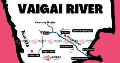
8. Vaigai
- Length: 258 km
- Origin: Varushanad Hills, Tamil Nadu
- State Covered: Tamil Nadu
- Famous For: Madurai city
List of West Flowing Rivers of India
West flowing rivers in India primarily drain into the Arabian Sea. These rivers generally originate from the Western Ghats, the Aravalli hills, or central India, and travel shorter distances compared to rivers that flow east. Their westward flow is mainly due to the westward slope of the Western Ghats and adjoining terrains, which naturally directs water toward the Arabian Sea. Some important west flowing rivers include the Narmada, Tapi, Mahi, Sabarmati, Mandovi, Zuari, Netravati, and Periyar.
1. Narmada
- Length: 1,312 km
- Origin: Amarkantak Plateau, Madhya Pradesh
- States Covered: Madhya Pradesh, Maharashtra, Gujarat
- Mouth: Arabian Sea
- Known For: Flows through the scenic Marble Rocks at Bhedaghat
2. Tapi (Tapti)
- Length: 724 km
- Origin: Satpura ranges, Madhya Pradesh
- States Covered: Madhya Pradesh, Maharashtra, Gujarat
- Mouth: Arabian Sea
- Known For: Ukai Dam
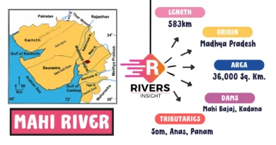
3. Mahi
- Length: 583 km
- Origin: Madhya Pradesh
- States Covered: Rajasthan, Gujarat
- Mouth: Arabian Sea
- Unique Feature: Flows northward briefly, then westward—forms a zigzag pattern
4. Sabarmati
- Length: 371 km
- Origin: Aravalli Hills, Rajasthan
- States Covered: Rajasthan, Gujarat
- Mouth: Arabian Sea
- Known For: Ahmedabad city is situated on its banks
5. Mandovi
- Length: 77 km
- Origin: Karnataka
- States Covered: Karnataka, Goa
- Mouth: Arabian Sea
6. Zuari
- Length: 92 km
- Origin: Western Ghats, Goa
- State Covered: Goa
- Mouth: Arabian Sea
7. Netravati
- Length: 103 km
- Origin: Chikkamagaluru district, Karnataka
- State Covered: Karnataka
- Mouth: Arabian Sea near Mangalore
8. Periyar
- Length: 244 km
- Origin: Western Ghats, Kerala
- State Covered: Kerala
- Mouth: Arabian Sea
- Significance: Known as the lifeline of Kerala, supports
- Dam: Idukki Dam
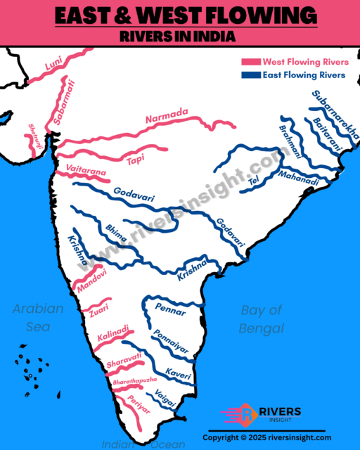
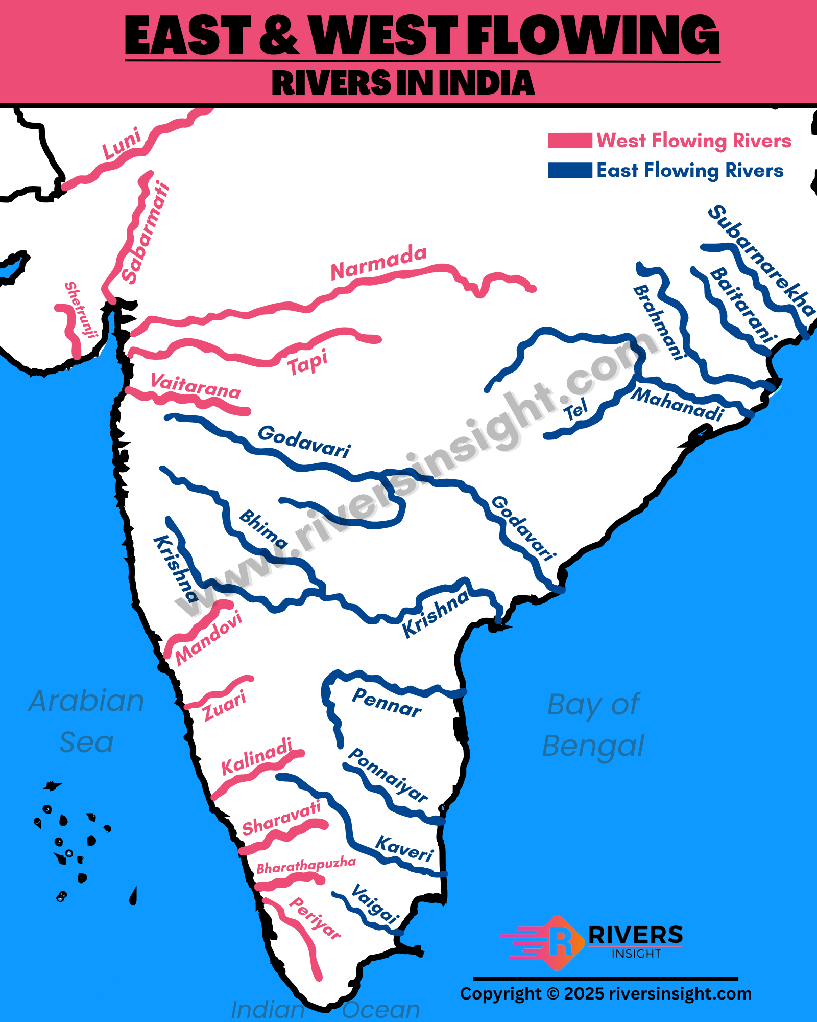
Map of East and West Flowing Rivers in India
Difference Between East and West Flowing Rivers of India
East flowing rivers are more in number and usually longer. They have gentle slopes and form large deltas. Whereas, West flowing rivers are fewer and shorter. They flow faster because of steeper slopes and form estuaries. These differences happen because of the shape of the land and the location of the Western Ghats.
| Feature | East Flowing Rivers | West Flowing Rivers |
|---|---|---|
| Direction of Flow | Flow into the Bay of Bengal | Flow into the Arabian Sea |
| Number | More numerous | Fewer in number |
| Length and Size | Generally longer with larger river basins | Usually shorter and smaller |
| Landforms Formed | Form large deltas | Form mostly estuaries |
| Origin | Eastern slopes of Western Ghats or central India | Western slopes of Western Ghats or western regions |
| Flow Speed and Gradient | Gentler slope with slower flow | Steeper slope with faster flow |
| Examples | Godavari, Mahanadi, Krishna, Cauvery | Narmada, Tapi, Mahi, Sabarmati |
Why Do Rivers Flow East or West in India?
The direction in which rivers flow depends mainly on the shape and slope of the land. In India, most of the land slopes from west to east, which is why many rivers flow east into the Bay of Bengal. The Western Ghats, a mountain range running parallel to the west coast, also influence the flow direction.
- Rivers starting on the eastern side of the Western Ghats flow eastward.
- Rivers originating on the western side of the Western Ghats flow westward.
- The height and slope of the land determine the speed and path of the rivers.
This natural tilt of the Indian peninsula and the position of the Western Ghats play a key role in directing river flow toward the east or west. This is why most rivers in India flow east while only a few flow west.