Missouri River | Map, Length, Source, Dams & Facts
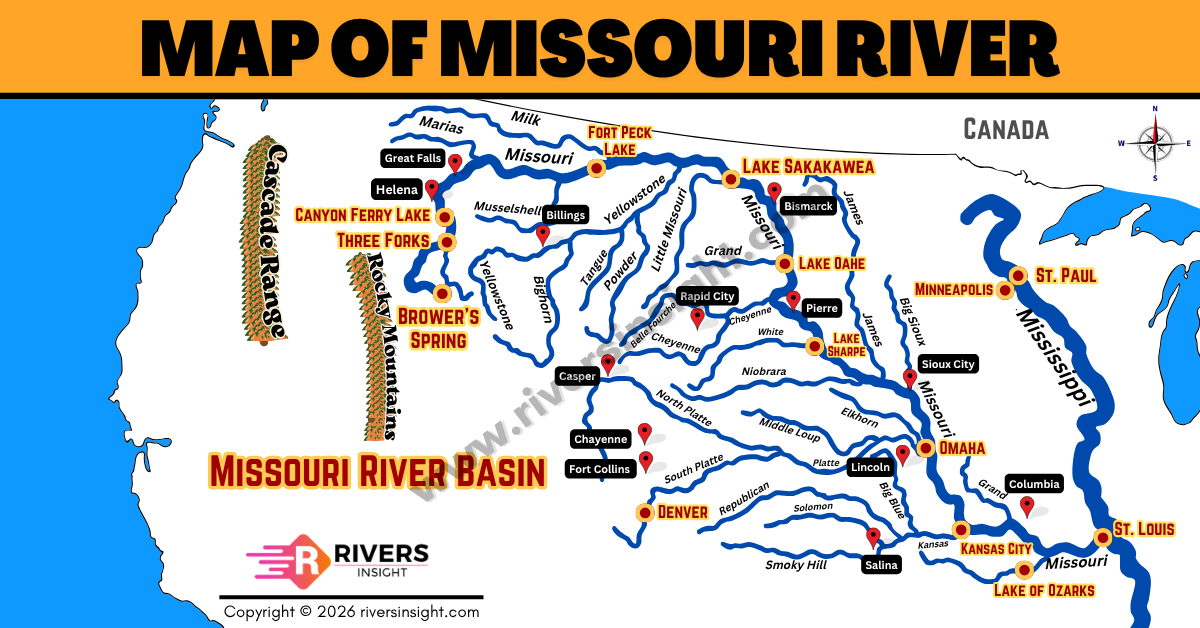
Missouri River is the longest river in North America and one of the most important river systems in the United
Read More
Missouri River is the longest river in North America and one of the most important river systems in the United
Read More
Odisha is a coastal state in eastern India with a coastline of around 480 kilometers along the Bay of Bengal.
Read More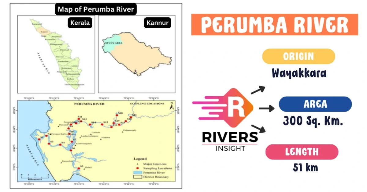
The Perumba River, also known as the Payyannur River, is an important watercourse that flows through the scenic Kannur and
Read More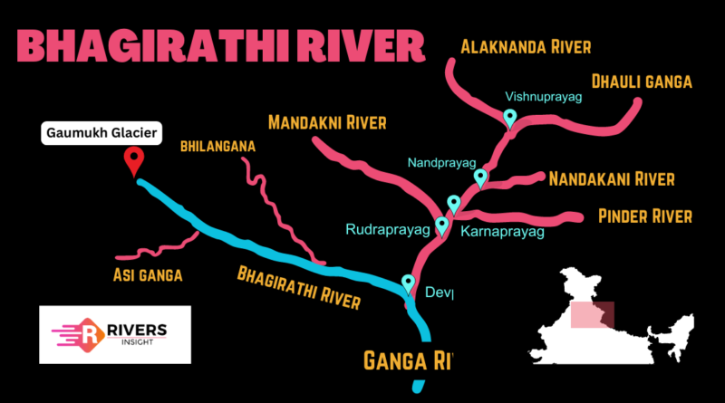
Bhagirathi River is a significant tributary of the Ganges River in India, originating from the Himalayas and flowing through Uttarakhand.
Read More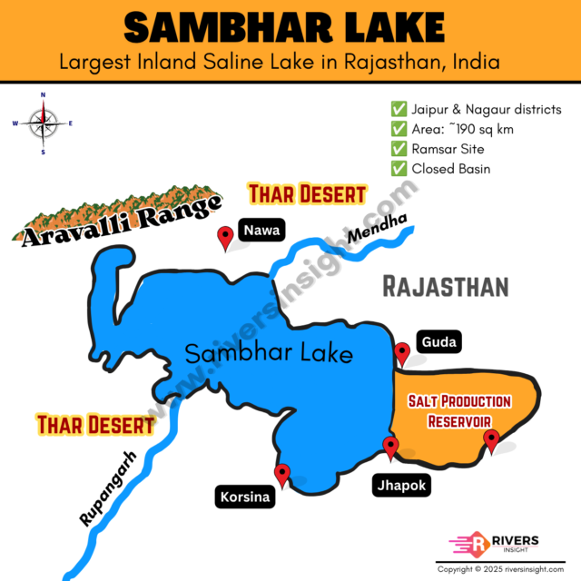
Sambhar Lake is the largest inland saline lake in India, located in Rajasthan across Jaipur, Nagaur, and Ajmer districts. Spread
Read More
India is home to a vast network of Himalayan and Peninsular rivers, many of which rank among the most significant
Read More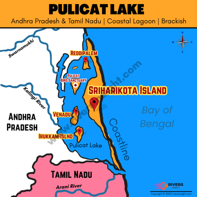
Pulicat Lake is the second-largest brackish water lagoon in India after Chilika Lake, located along the Coromandel Coast on the
Read More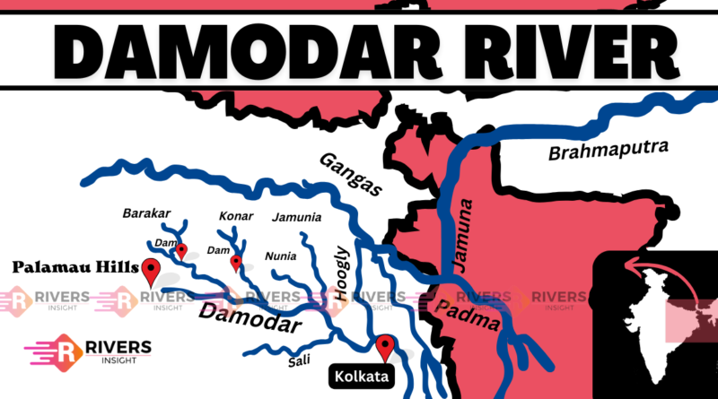
Damodar River, often called the Sorrow of Bengal, is a major river of eastern India flowing through Jharkhand and West
Read More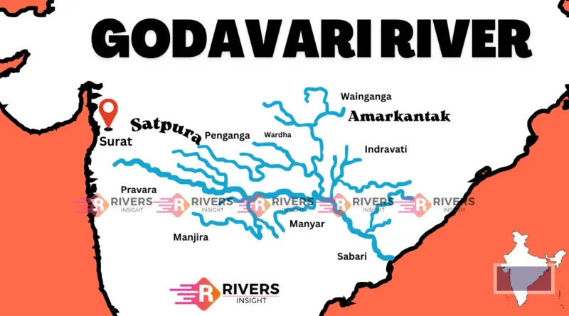
Godavari River is also known as the ‘Dakshina Ganga or Vridha Ganga,’ and originates from the Brahmagiri Hill near Trimbakeshwar
Read More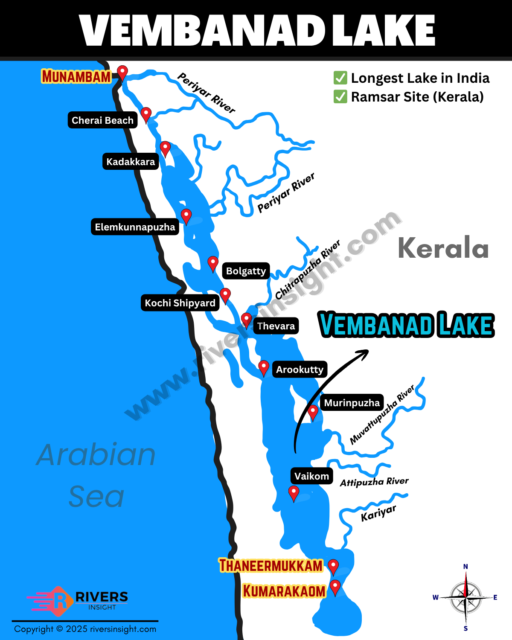
Vembanad Lake is the longest lake in India and one of the most important water bodies in Kerala. It is
Read More