List of 10 Major Rivers in Tamil Nadu with Map
Tamil Nadu, the 10th largest state in India with an area of 130,058 km², is located in the southern part
Read More
This section covers rivers of Indian states. For each state, we have shared the main rivers, where they start, how they flow, and which districts they pass through. You will also find useful maps for better understanding. For example, we have explained the rivers of Uttar Pradesh, Maharashtra, Bihar, Tamil Nadu, and many more.

Tamil Nadu, the 10th largest state in India with an area of 130,058 km², is located in the southern part
Read More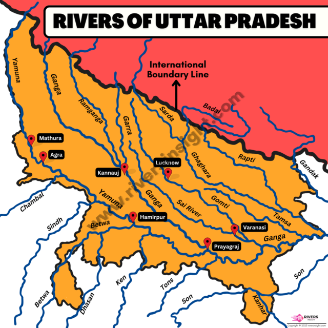
Uttar Pradesh is drained by some of the most important rivers of India, including the Ganga, Yamuna, and their major
Read More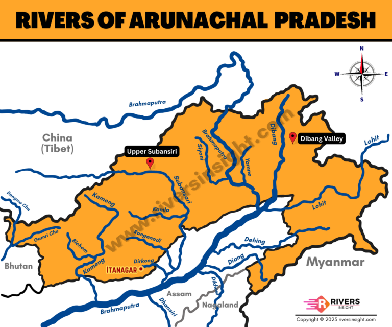
Arunachal Pradesh is a river-rich state located in the northeastern Himalayas. It forms a major part of the Brahmaputra River’s
Read More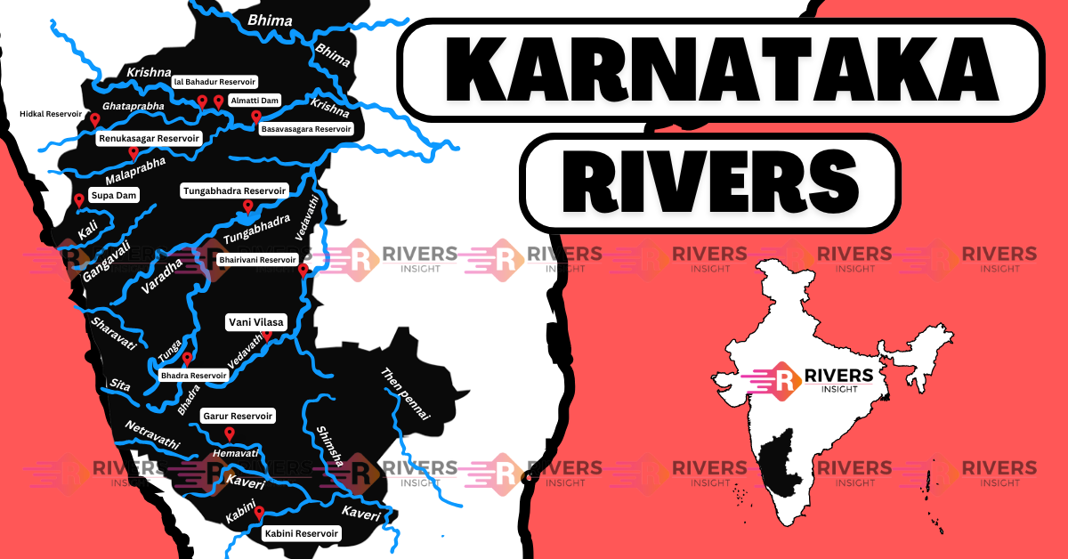
Karnataka is a state in the southwestern region of India, bordered by Maharashtra to the north, Goa to the west,
Read More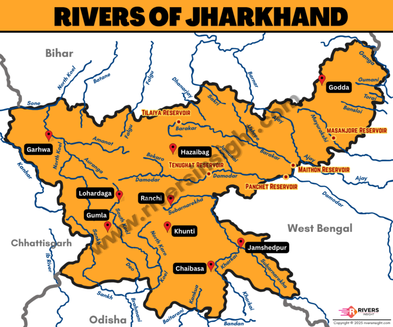
The rivers of Jharkhand originate mainly from the Chotanagpur Plateau and flow through forests, hills and valleys. Most of these
Read More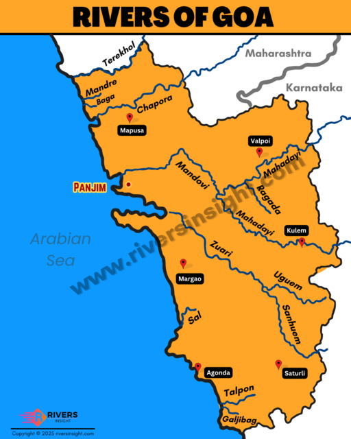
Goa is India’s smallest state by area, located on the western coast. It shares borders with Maharashtra in the north,
Read More
Telangana is a state in south-central India. It covers an area of about 112,000 square kilometers. The state touches Maharashtra
Read More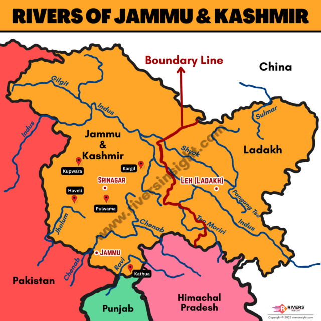
Jammu and Kashmir and Ladakh are northern Union Territories of India, sharing borders with Himachal Pradesh, Punjab, and international borders
Read More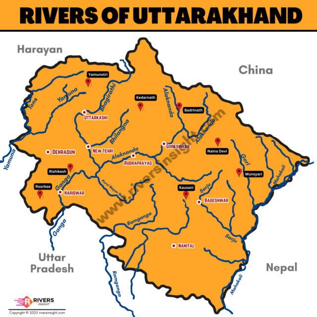
Uttarakhand is a Himalayan state in northern India, covering an area of about 53,483 square kilometers. It borders Himachal Pradesh
Read More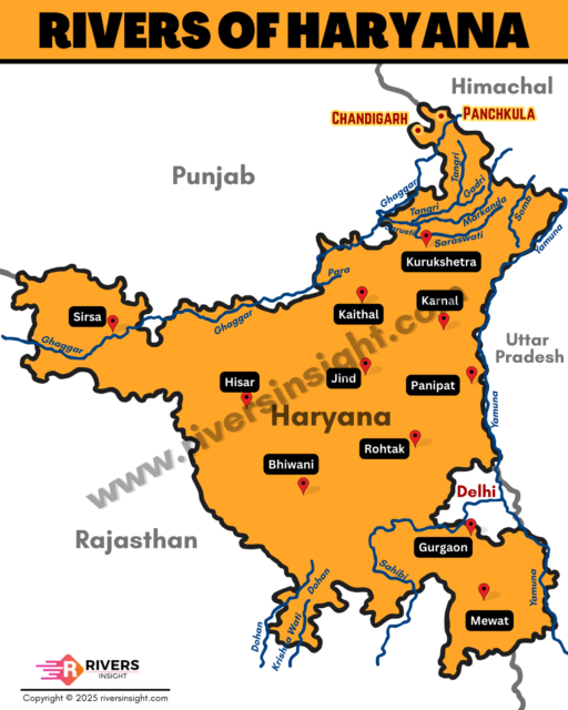
Haryana is a northern state of India with a total area of about 44,200 square kilometers. It lies between the
Read More