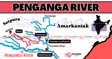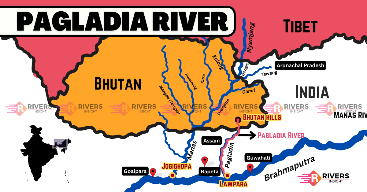
Pagladiya River of Assam with Map
The Pagladiya River is a north bank tributary of the Brahmaputra River in Assam, India. It begins its journey in the foothills of Bhutan and flows through the Baksa and Nalbari districts before meeting the Brahmaputra at Lawpara village.
Table of Contents
Geographical and Hydrological Features
The river is rainfed and shallow, yet perennial. Its character is shaped by:
- Seismic activity zones
- Heavy monsoons
- Sandy and erodible floodplains
These natural forces cause frequent lateral shifting, bank erosion, and formation of abandoned channels like the Mora Pagladiya.
| Government Source: Water Resources Department – Assam
Floods and the Controversial Pagladiya Dam
The Pagladiya floods regularly submerge farmlands and settlements. To counter this, a dam was first proposed in 1968 as a flood control measure.
Timeline of the Dam Project:
- 1968: Proposed as a minor dam for flood prevention (Rs. 126 million)
- 1984-85: Taken over by the Brahmaputra Board and scaled up as a multipurpose project (Rs. 5.4 billion)
- 2001: Approved by the Government of India
However, construction is stalled due to:
- Opposition by local indigenous families
- Shifting river course complicates engineering
- Displacement concerns and inadequate rehabilitation
| Reference: Brahmaputra Board – Ministry of Jal Shakti
Indigenous Water Management – “Dong” Systems
The Bodo tribes of Assam have developed traditional methods to tap into the Pagladiya’s waters.
Key Features of the “Dong” System:
- Small dams using tree branches, stones, and mud
- Earthen canals (dongs) to divert water
- Storage ponds called pukhuris
- Convex dams regulate flow
- Managed by community councils
- Irrigation based on a fixed schedule (twice daily)
Aquatic Biodiversity in the Pagladiya River
The river hosts rich biodiversity, especially suited to its changing flow. Documented species include:
Fish Species:
- Cyprinids (carp-like)
- Catfish
- Perch
- Eels
Mollusks:
- 6 known species
- Spread across 2 classes and 4 families
These species adapt to sediment shifts and migrate during floods, helping maintain ecosystem health.
Water Quality Monitoring
Water quality is monitored under India’s National Water Quality Monitoring Programme (NWMP). The river generally meets norms, but during floods, breaches can lead to:
- High BOD (Biochemical Oxygen Demand) levels
- Localized contamination
| Source: CPCB Water Quality Reports