Tel River: Origin & Map
Tel River is the second-largest river in Odisha and the largest tributary of the Mahanadi River. It stretches for approximately 296 km, with a drainage area of about 22,818 km², making it a significant river system in the state.
Table of Contents
Origin and Course
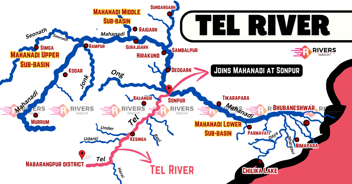
Tel River originates in the plains of Nabarangpur district, near the Odisha-Chhattisgarh border, close to the Amravati forest range. It begins its journey about 32 km west of Jorigam and flows through several districts of Odisha before finally meeting the Mahanadi River at Sonpur (Subarnapur).
The river’s drainage basin covers approximately 22,818 km², of which 11,960 km² extends up to Kesinga, and 19,600 km² stretches up to Kantamal. Further, the Tel River basin itself spans an area of 2,756 km², lying between latitude 19° 15′ 32.4″N and 20° 45′ 0″ N and longitude 82° 3′ 36″ E and 84° 18′ 18″E.
It flows through the following districts of Odisha:
- Nabarangpur
- Kalahandi
- Balangir
- Sonpur
Tributaries
The Tel River is fed by several tributaries that contribute to its flow and maintain its ecological balance. Some of the significant tributaries include:
- Udanti River
- Indra River
- Ret River
- Hati River
- Sagada River
Cultural and Religious Significance
One of the most notable religious sites along the Tel River is the Kosaleswar Temple, located on its left bank about 14 km southeast of Subarnapur. This temple, originally an early Buddhist shrine, was later refurbished by Hindus and now stands as a prominent place of worship and historical interest.