10 Major Rivers of Uttar Pradesh: Map & Key Facts
Uttar Pradesh is drained by some of the most important rivers of India, including the Ganga, Yamuna, and their major
Read More
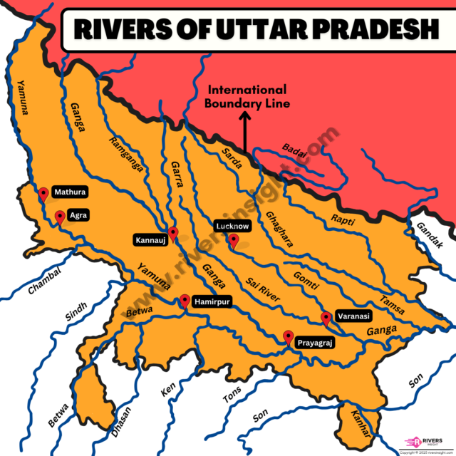
Uttar Pradesh is drained by some of the most important rivers of India, including the Ganga, Yamuna, and their major
Read More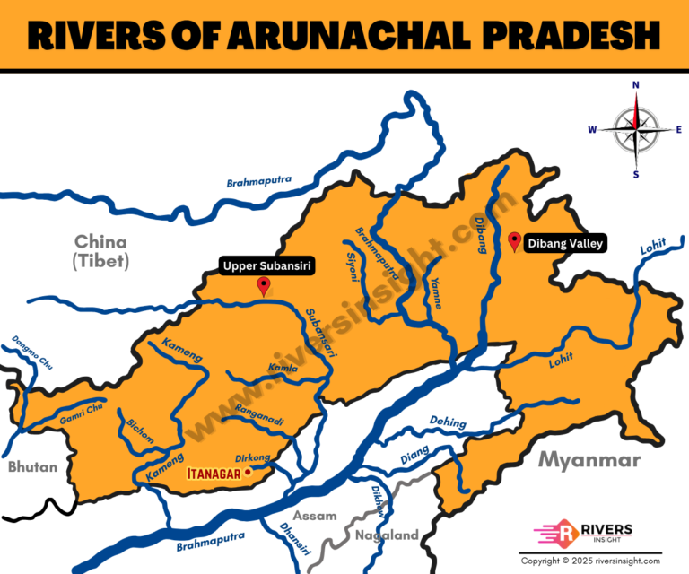
Arunachal Pradesh is a river-rich state located in the northeastern Himalayas. It forms a major part of the Brahmaputra River’s
Read More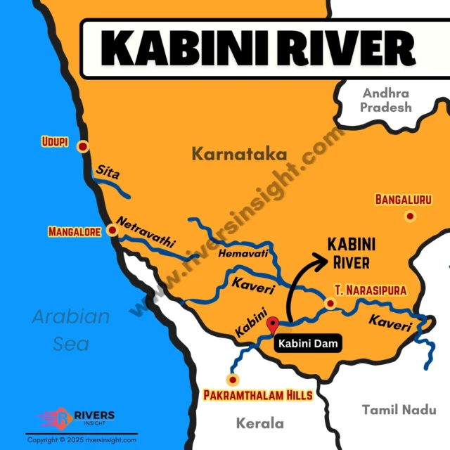
Kabini River is a major tributary of the Cauvery, flowing through the states of Kerala and Karnataka. It originates in
Read More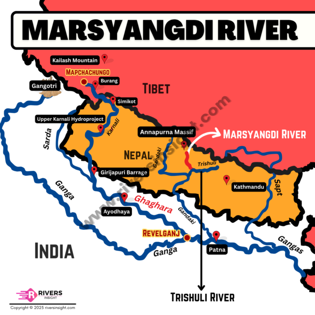
Marsyangdi River is a major river in central Nepal and has a total length of about 150 km. It originates
Read More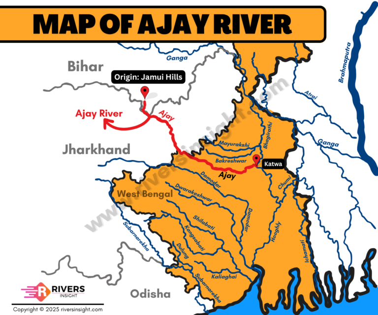
Ajay River is a seasonal river that flows through Bihar, Jharkhand, and West Bengal, eventually merging with the Bhagirathi-Hooghly River
Read More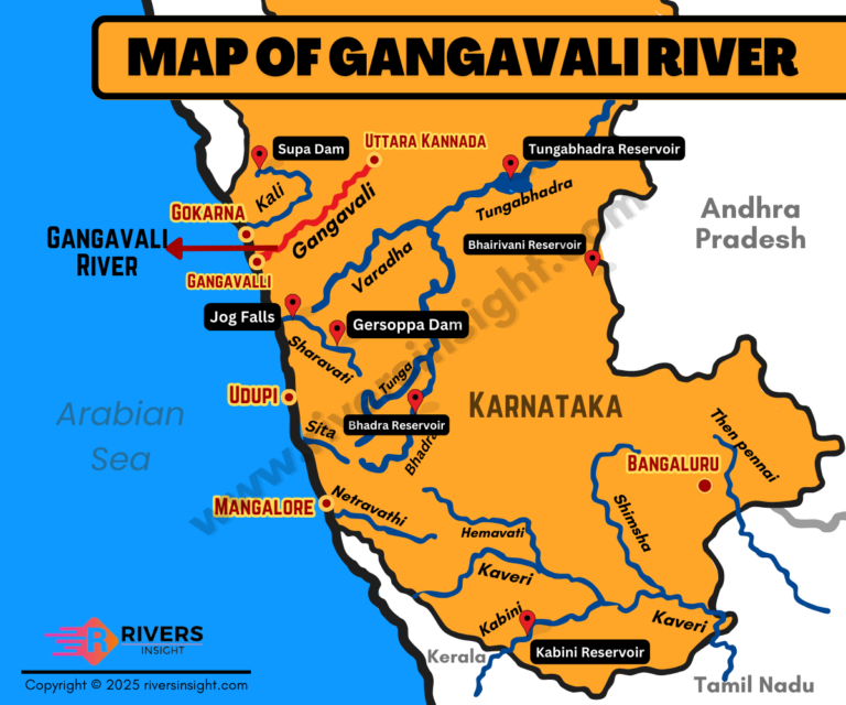
The Gangavali River is also known as the Bedthi River in some parts of Karnataka. It flows mainly through Dharwad
Read More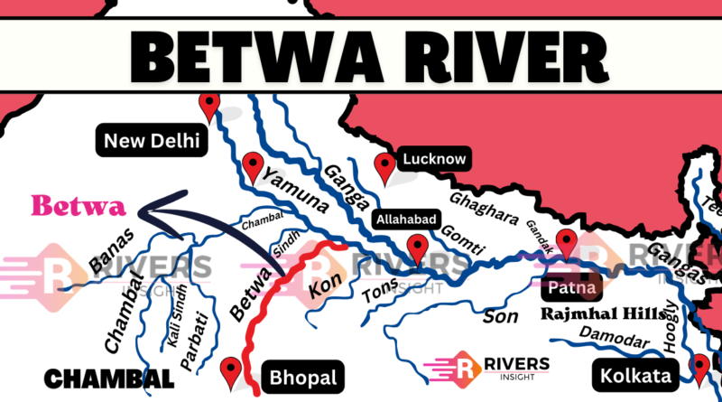
The Betwa River is a right-bank tributary of the Yamuna River. It flows through central India and holds both historical
Read More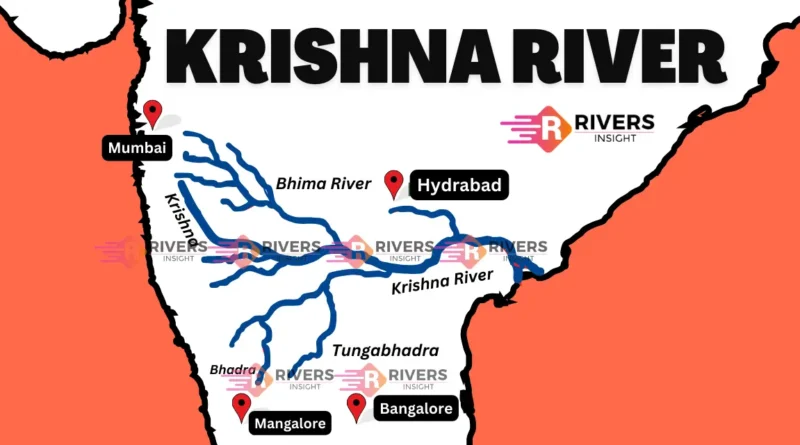
The Krishna River is a major river in India and is a prominent geographical feature that originates from the Western
Read More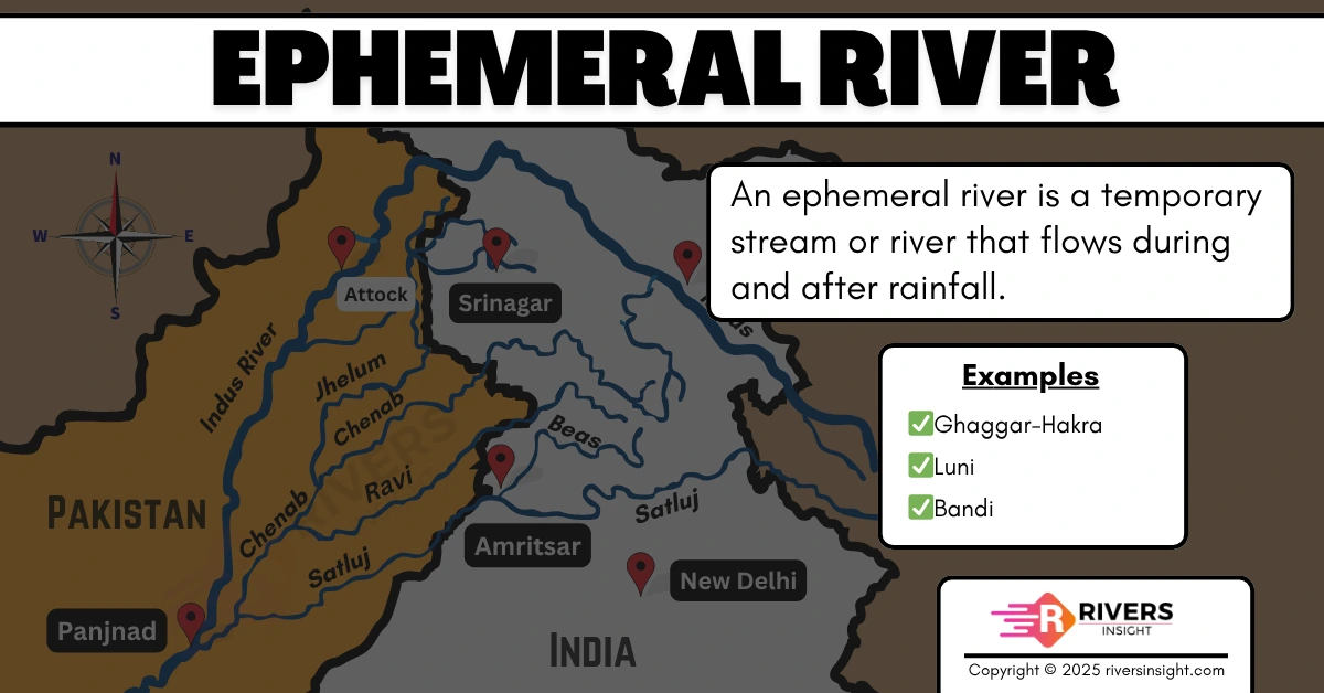
An ephemeral river is a type of river that flows only during periods of significant rainfall. Unlike perennial rivers that
Read More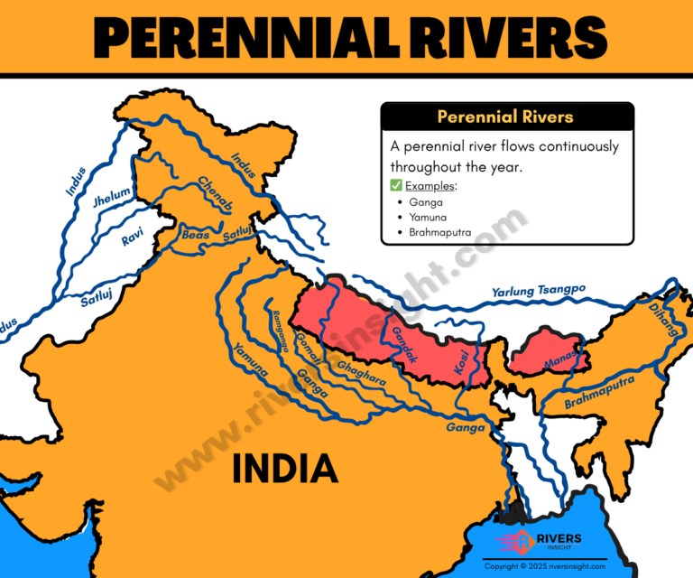
What is a Perennial River? A perennial river is a river that flows throughout the year, regardless of the season.
Read More