Karamana River: Map, History, Pollution & Key Facts
Karamana River is a short west-flowing river located entirely within Thiruvananthapuram district of Kerala. It originates in the Western Ghats
Read More
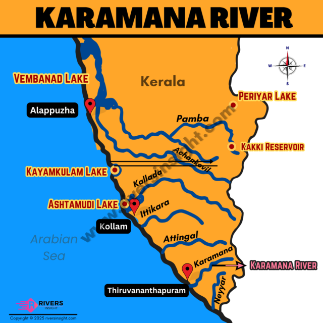
Karamana River is a short west-flowing river located entirely within Thiruvananthapuram district of Kerala. It originates in the Western Ghats
Read More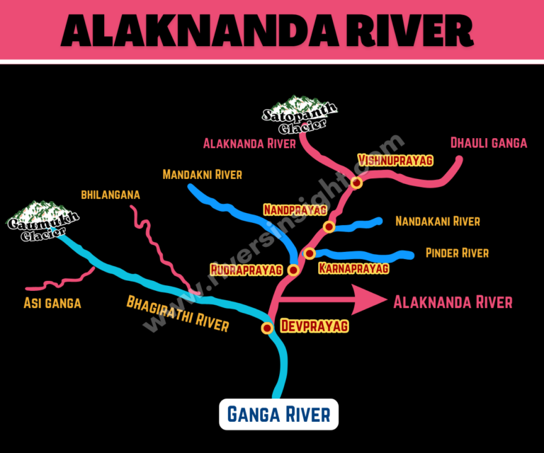
The Alaknanda River is a major source stream of the Ganga, flowing through the Garhwal Himalayas in Uttarakhand. It originates
Read More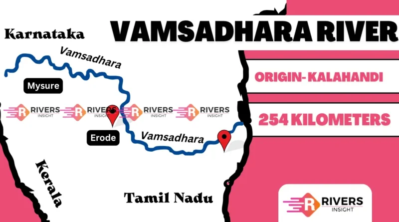
The Vamsadhara River derives its name from the combination of ‘bansa,’ meaning bamboo, and ‘dhara,’ meaning water flow. Originating from
Read More
The Colorado River is one of the most iconic rivers in the United States, flowing through the arid landscapes of
Read More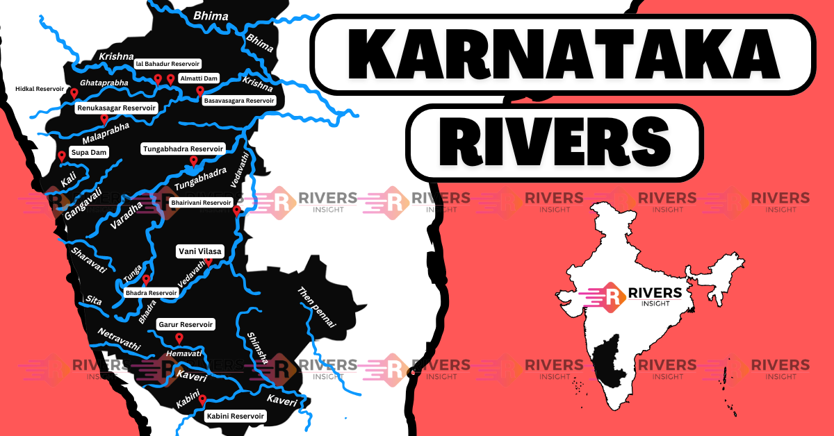
Karnataka is a state in the southwestern region of India, bordered by Maharashtra to the north, Goa to the west,
Read More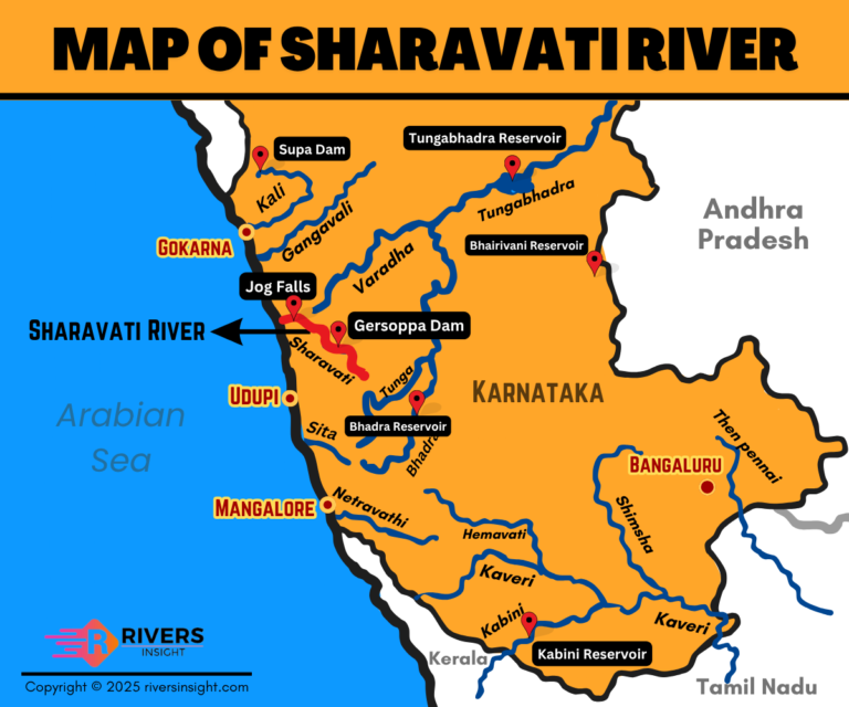
Sharavati River is an important west-flowing river in the state of Karnataka. It is best known for forming the famous
Read More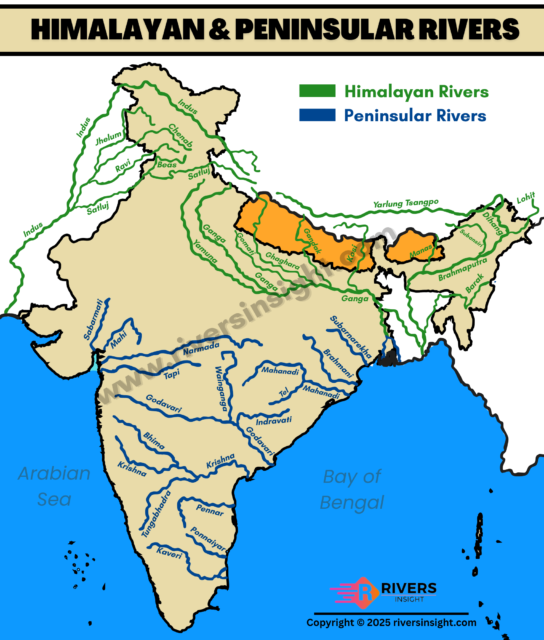
The difference between Himalayan and Peninsular rivers is one of the most commonly asked questions in Indian geography. Indian rivers
Read More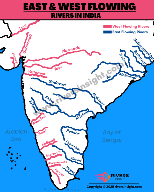
Rivers in India are broadly classified into two types based on their flow direction — east flowing rivers and west
Read More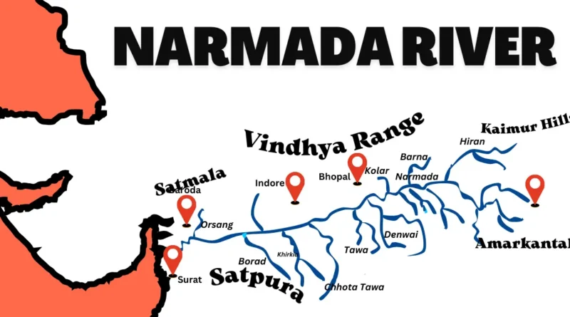
The Narmada River, central India’s lifeline, starts in Madhya Pradesh’s Maikal Range and flows through Gujarat and Maharashtra before emptying
Read More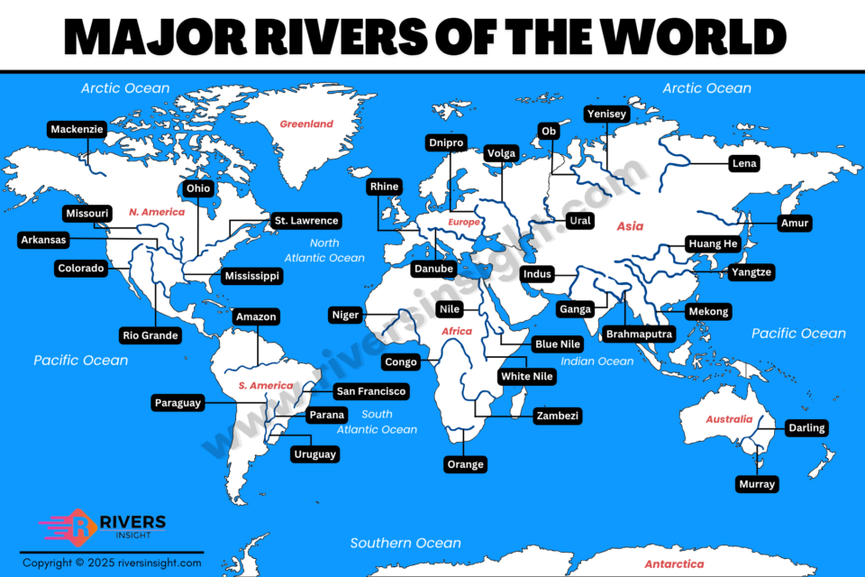
Searching for the major rivers of the world? This article gives you a complete list of the most important rivers
Read More