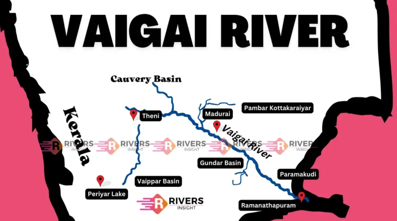
Vaigai River in Tamil Nadu
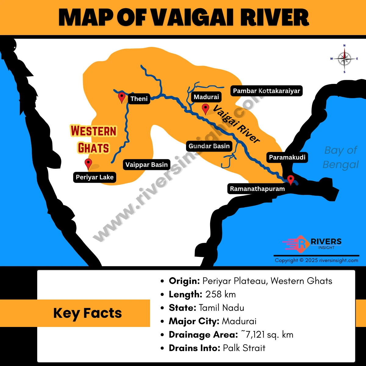
Vaigai River is an important river in southern Tamil Nadu. It originates from the Periyar Plateau in the Western Ghats and flows southeast through Theni, Dindigul, and Madurai districts before draining into the Palk Strait (Bay of Bengal).
Vaigai River Map
Origin, Start & End Point
- Origin: Periyar Plateau, Western Ghats
- Starting Point: Near Theni district
- End Point (Mouth): Palk Strait (Bay of Bengal)
- Drainage: Flows entirely within Tamil Nadu
Advertisements
👉 Important: The Vaigai River is not a tributary of any major river; it flows independently into the sea.
Key Facts
- Length: 258 km
- State: Tamil Nadu
- Major City: Madurai
- Drainage Area: ~7,121 sq. km
- Drains Into: Palk Strait
Tributaries
Major tributaries include:
- Siruliar River
- Varaha Nadhi
- Gundar River
- Thenkaraiyar River
- Kottagudi River
👉 These tributaries originate mainly from the Western Ghats and nearby hill ranges, supporting the Vaigai basin.
Vaigai Dam & Important Features
- Vaigai Dam: Major irrigation project supporting agriculture
- Madurai City: The river flows through this historic city
- Waterfalls: Suruli Falls, Kumbakarai Falls, Thalaiyar Falls