
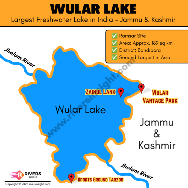
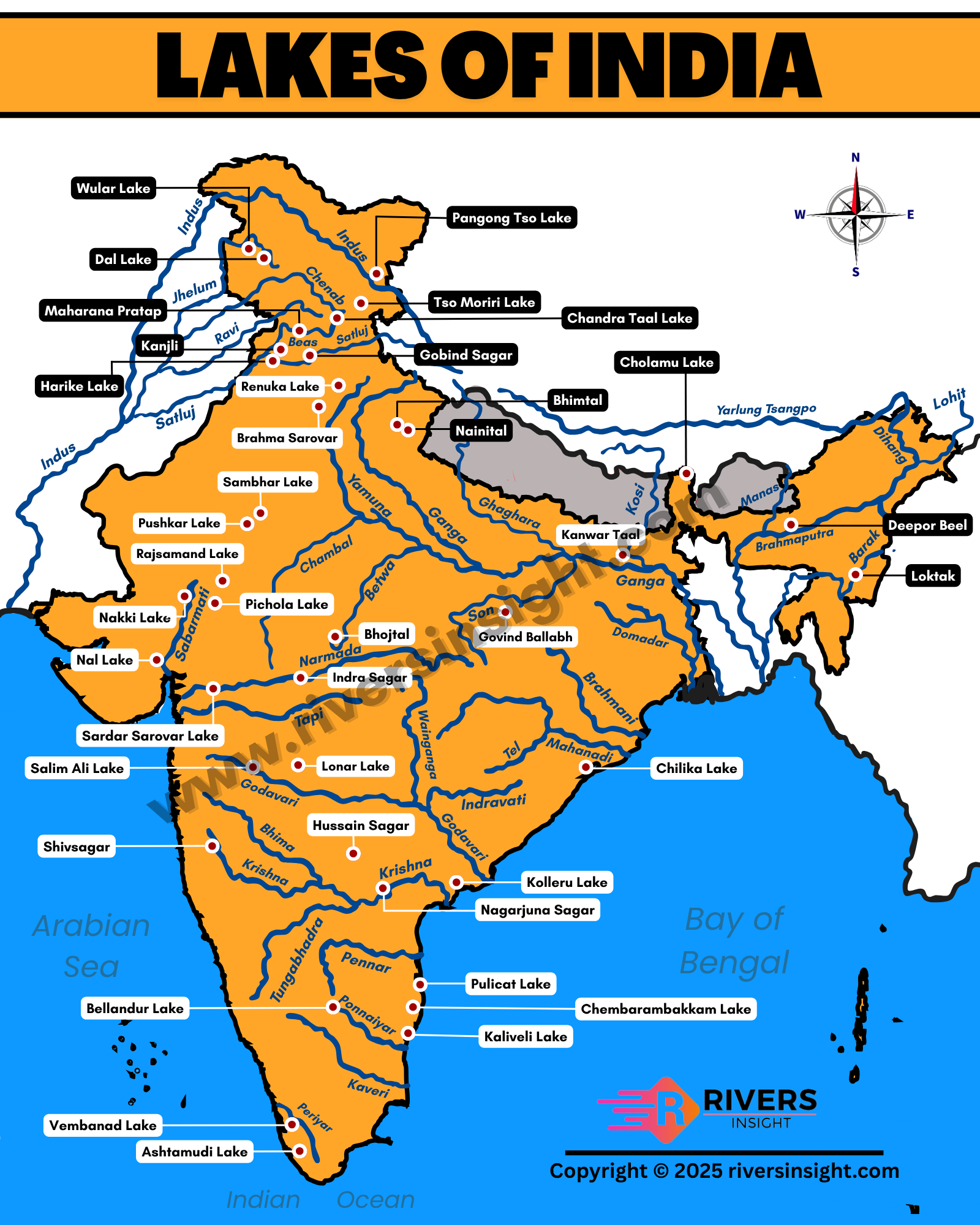
Wular Lake | Map, Location, and Facts
Wular Lake is the largest freshwater lake in India and the 2nd largest in Asia. It is located in Jammu and Kashmir, in the Kashmir Valley. It can be easily located on the map of India in the northern region.
Table of Contents
Location & Map of Wular Lake
Wular Lake is situated in the Bandipora district of Jammu and Kashmir, about 40 km from Srinagar.
- State: Jammu & Kashmir
- District: Bandipora
- Region: Kashmir Valley (Himalayan region)
The lake lies at the foothills of the Haramuk Mountain, which is a part of the Great Himalaya. Further, it is part of the same geographical region as Dal Lake, but is much larger.
River System & Water Sources
The lake is mainly fed by the Jhelum River, which flows into and out of the lake.
Other important sources include:
- Madhumati stream
- Arin stream
Ramsar Status & Wetland Importance
Wular Lake was designated a Ramsar Wetland Site in 1990, underscoring its global ecological importance. The lake supports migratory birds, fish species, and wetland vegetation, making it an important part of the Kashmir Valley ecosystem.
Official details are available on the Ramsar Convention website.
Area & Physical Features
- Area: Around 189 sq km (varies seasonally)
- Altitude: ~1,580 metres
- Type: Freshwater lake
Island & Project
There is a small island in the lake known as Zaina Lank.
- Built by Sultan Zain-ul-Abidin
- Shows the historical importance of the lake
In ancient texts, Wular Lake was known as Mahapadmasar, mentioned in the Nilamata Purana.
Tulbul Project (Important Fact)
At the outlet of Wular Lake, a project called the Tulbul Navigation Project was developed.
It aims to:
- Regulate water flow
- Improve navigation in the Jhelum River